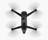
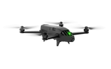
The Parrot Bluegrass is a versatile quadcopter specifically designed for agriculture, which helps farmers to improve the yield of their crop based on the data collected by the two onboard cameras: the Full HD video camera and the revolutionary Parrot multispectral sensor. Sequoia!
With its Full HD video camera on the front of the drone, this solution allows farmers to visually monitor their infrastructure, land and herds. Thanks to the advanced multispectral sensor designed for precision farming and the use of the Airinov First + data analysis solution, farmers benefit from a turnkey solution to ensure the health of their crops.
The Parrot Bluegrass is easy to carry with its removable propellers, easy to fly thanks to its autonomous flight capacity and easy to repair.
The Parrot Bluegrass package includes:
- 1 Parrot BlueGrass
- 1 Parrot Sequoia
- 3 batteries
- 1 Skycontroller 2
- 1 backpack
- 2 chargers and 3 country adapters
- 1 USB to micro-USB cable
- 1 quick start guide
- 1 year subscription to the AIRINOV FIRST + agricultural mapping platform
- 1 month of Pix4Dag subscription - desktop and cloud use
KNOW THE HEALTH STATUS OF CULTURES
The Parrot Bluegrass drone is equipped with the advanced Parrot Sequoia sensor. Using 4 different sensors, Parrot Sequoia analyzes the amount of light absorbed and reflected by the plants to determine their state of health.
The multispectral sensor detects the light that plants reflect on four frequency bands: green, red and two infrared bands, invisible to the human eye.
Above, a sunshine sensor records the intensity of the ambient light to ensure the consistency of the measurements in different sunshine conditions thanks to the radiometric calibration.

A MULTIPURPOSE DRONE FOR YOUR FARM
Designed to be easy to fly and easy to handle, the Parrot Bluegrass combines aerodynamic design, advanced autopilots, powerful engines and long battery life.
The drone can be controlled very precisely thanks to the Parrot Skycontroller 2 ensuring a range of 2km.
Parrot Bluegrass retransmits live video camera footage to the controller, allowing the farmer to inspect his farm, monitor his flocks, and get an overview of his land.
AUTOMATIC CARTOGRAPHY OF EACH PLOT WITH PIX4DCAPTURE
Pix4Dcapture is a simple and intuitive application for creating and automatically planning a flight plan over your parcels.
The interface makes it possible to very precisely define the zones to be mapped, to define the flight altitude and allows a permanent follow-up of the progress of the mission.
Parrot BlueGrass can perform autonomous flights allowing it to cover up to 30 ha at 70 m altitudes.
EASILY DESIGN A FLIGHT PLAN
Optimized for the Parrot Bluegrass drone and available on mobile or tablet, Pix4Dcapture allows defining a flight plan to map a farm.
Just adjust different parameters such as the altitude and the area to be mapped.

A PLATFORM TO SIMPLIFY DECISIONS AND AGRICULTURE
AIRINOV FIRST + IS A SIMPLE, ACCURATE AND USER-FRIENDLY AGRICULTURAL MAPPING PLATFORM
Like an X-ray or scanner, it transforms the data captured by the drone into a simple or detailed zonation map and an NDVI map showing the state of the vegetation of the parcel being mapped.
It then becomes easy and quick to accurately visualize problem areas and make the right decisions.
To access it, just create an account, and upload your photos in the cloud to generate a report.
THIS SOLUTION MEETS THE FOLLOWING NEEDS
CROP INSPECTION AND ANALYSIS
Analyze crops and orchards from the sky to evaluate and optimize their health
Parrot professional solutions make life easier for farmers by enabling them to carry out aerial surveillance work on their fruit tree farms, vineyards, red fruits, rapeseed or cereals.
The data collected during the flight of the drone allow a radiography of an unprecedented precision to identify the needs of each parcel: NDVI maps and zonings.
No knowledge of flying drone is necessary.
The multispectral sensor detects the light that plants reflect on four frequency bands: green, red and two infrared bands, invisible to the human eye.
Above, a sunshine sensor records the intensity of the ambient light to ensure the consistency of the measurements in different sunshine conditions thanks to the radiometric calibration.


