Tested By Experts. Ready For You.
Every DJI Refurbished aircraft is thoroughly tested by DJI Experts and includes DJI standard warranty.
There are no better experts in DJI products than those at DJI. Every refurbished product has undergone a professional refurbishing process that brings it up to the same high standards as brand new products, and all refurbished products come with new parts, new packaging and DJI's standard Manufacturer Warranty. If you are not happy with a refurbished product and have not yet activated it, you can return it within seven days of receipt for a full refund or a replacement refurbished product.
DJI Refurbished Product FAQ
Q1. WHAT ARE DJI REFURBISHED PRODUCTS?
The products sent back by customers within seven days after he/she confirms receipt will be strictly examined, refurbished and repackaged, and sold as DJI refurbished products. Currently offered DJI refurbished products include the Phantom 3 Standard/Advanced/Professional and Phantom 4.
Q2. ARE DJI REFURBISHED PRODUCTS’ QUALITY GUARANTEED?
DJI promises you that every refurbished product is tested thoroughly, and that the quality and the appearance of refurbished products is the same as with new products.
Q3. WHAT KIND OF AFTER-SALE SERVICE ARE DJI REFURBISHED PRODUCTS ELIGIBLE FOR?
The after-sale service policy for DJI refurbished products is identical to that of new products. However, refurbished products can only be exchanged for refurbished products, not new products.
Q4. WHAT IS INCLUDED IN THE PACKAGE?
Refurbished models include everything that is found in a new package.
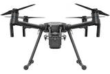
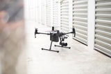
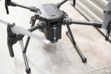
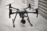
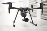
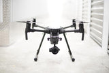
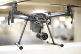
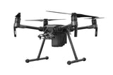
The DJI Matrice 200 quadcopter is an economical single-gimbal drone for industrial and first-responder applications. It is powerful, maneuverable and adaptable to a broad range of uses. It ships only with a built-in First Person View camera that’s used strictly for navigation.
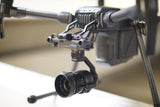
Since the Matrice 200 is shipped without a recording camera, you can equip your drone with a camera that best suits your needs. And since compatible gimbal-mounted cameras are removable, you can get more than one camera, if that’s what your industry requires. Shoot with one camera — perhaps a thermal-imaging camera. Then remove it, mount a high-definition video/still camera, and shoot with that. Switch back when you want.
Choose the camera that works best for firefighting, law enforcement, security, precision agriculture, engineering, construction site mapping, or utilities or infrastructure inspections. Options include cameras that shoot thermal images, a camera with an action-freezing leaf shutter, a camera with a powerful zoom lens, and a camera that accepts interchangeable lenses, two of them zoom lenses.
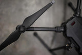
The M200 boasts IP43 resistance to solid objects and moisture — you can use it in light rain — and is sized to remain stable in brisk crosswinds. Its foldable body, plus removable batteries, propellers and landing gear, mean that it stores and transports easily in the included case.
Every Matrice 200 includes:
- Foldable body, removable landing gear
- Foul-weather resistance
- DJIGo flight program
- Precise GPS positioning
- Subject tracking
- Built-in FPV camera
- 51.4 mph maximum speed
- 4.3-mile range (extendable)
- 20-27 minutes maximum flight with varying payloads
- Remote controller compatible with smartphones/tablets
- 16GB microSD card; compatibility with card up to 128GB
- One downward-facing gimbal mount
- Automatic/manual camera control
- Compatibility with a range of thermal-imaging and video/still cameras
- Adaptability to dual controls
Matrice 200: Powerful Quadcopter
The Matrice 200 can fly at a maximum speed of 51.4 mph. The Matrice can ascend at more than 11 mph and descend at nearly 7 mph. Because the Matrice’s arms unfold to nearly 35 inches, it is stable in crosswinds up to 22 mph. It can operate at up to 8,200 feet above sea level.

Resistance to Foul Weather, Solid Objects
The Matrice 200 is engineered to IP43 standards. That means it can resist solid objects in excess of 1mm in diameter and water sprayed from all directions, even at a 60-degree angle. The Matrice, which has a hard shell body, is usable in rain. If used over sandy and dusty environments, it should be checked for and cleaned of foreign debris after use. The Matrice 200 can be flown in temperatures as low as -4F.
Long Range
The Matrice 200 remote controller’s signals extend 4.3 miles. An available FPVLR range extender can increase that up to 3x. Redux Air recommends professional installation by its trained technicians unless you have experience installing antenna hardware and firmware. Redux Air installation is fast and economical, involving the shipment of the remote controller only.
DJI Go 4 App
The DJI Go 4 flight control app is available for downloading to a smartphone or tablet. It is compatible with any operating system from iOS 9.0 or later, and Android 4.4.0 or later. The program offers Flight Autonomy and obstacle avoidance.

Remote Controller
The included remote controller sends and receives signals up to 4.3 miles. The controller connects to a smartphone or tablet, which displays drone movement as seen through the built-in FPV camera, which always points forward. It allows toggling from FPV to the camera view. The optional 7.85-inch CrystalSky monitor aids daytime viewing, with a display that’s more than four times brighter than most tablets.
Dual Controllers Available
Optional is the use of dual remote controllers in a master-slave arrangement. The pilot controls the drone on the master, and the camera operator controls camera movement and video/still recording on the slave. This allows for more detailed data collection during inspections. Additional remote controllers are available from Redux Air.
Intelligent Flight Batteries
Matrice runs on twin batteries. TB50 batteries, at 4280 mAh, are standard. For longer flight time, there are optional TB55 batteries, at 7760mAh. Matrice 200 batteries must be charged to within 13 percent of each other or takeoff is blocked. If one battery fails during flight, the pilot receives a warning and should land the drone. The batteries are self-heated, allowing flight in freezing temperatures. Insulation stickers are included.
Matrice Sensors
In addition to overhead infrared sensors for obstacle avoidance, Matrice 200 drones have downward and forward visioning sensors. The sensors add extra protection against striking obstacles during inspections, especially in tight or intricate environments.
Onboard, Mobile SDK
Every Matrice 200 drone has an onboard software development kit. This allows the development of industry-specific programs. Compatible platforms are Windows, Linux, Embedded Systems STM 32 and ROS. Mobile SDK allows the development of mobile apps for Matrice 200 drones on compatible iOS or Android phones and tablets.
Compatible High-Performance Cameras

Available are a range of professional-level Matrice 200-compatible cameras:
- XT — With thermal imaging by FLIR, the Zenmuse XT camera reveals heat sources, including at night. Available in four fixed-lens options. Imaging at 640/30fps or 336/30fps, depending on the model. Best uses Electrical tower inspections, solar panel inspections, search and rescue, firefighting, precision agriculture.
- Z30 — How close a view do you want, and from how far away? The Zenmuse Z30 has a fixed lens that zooms up to 30x, with 6x distortion-free digital zoom, for a maximum 180x magnification. Best uses Cell tower inspection, wind turbine inspection, firefighting.
- X4S — Detailed images are captured by a huge 1-inch sensor on the Zenmuse X4S. Its leaf shutter eliminates rolling distortion to capture fast action with a 24mm-equivalent lens. The X4S records 4K video at 6 fps in H.265 for superior slow motion or 4K at 30 fps in H.264. The transfer rate is 100mbps. Stills are 20MP shot in bursts up to 14fps. It has a fast autofocus. Best uses: High-quality aerial video and stills, including for mapmaking.
- X5S — With a range of interchangeable lenses and two zoom lenses, the Zenmuse X5S allows you to select the focal lengths that are ideal for your needs. Video is recorded in 5.2K or 4K. Stills are recorded in 20.89MP and shot in bursts up to 20fps. Aperture and shutter control is automatic or manual. Best uses: High-quality aerial video and still photography, including mapmaking.
Matrice 200 Has Broad Applications

The Matrice 200 can be applied to many professional uses, in addition to high-quality aerial video production and photography:
Firefighting: A Matrice mounted with a Zenmuse XT, an infrared camera that records thermal images, can detect heat sources, making it a lifesaving tool for firefighters. A Matrice so equipped can hover over a fire scene and reveal fire in walls and roofs. That helps firefighters know where to attack the blaze, step on a roof safely, and vent smoke. It also can spot hotspots that need further attention.
Search-and-rescue: An XT-equipped Matrice can scan snow from an avalanche, or the rubble left by an earthquake, fierce storm, explosion or terrorist attack for heat sources that may indicate buried survivors. It can also detect victims of a derailment or air crash who might have taken shelter in dense woods.
Police: Surveillance is conducted away from the subject, with automatic tracking of the subject as he moves. Close-up evidentiary and identification photos can be taken with zoom lenses.
Security: Thermal imaging can spot intruders hiding inside or outside buildings, and escapees hiding in dense foliage. Dogs may pick up the scent, but the Matrice can determine how far away escapees are, and it may capture images that show whether or not they are armed. The Matrice can patrol a sprawling roof, and it can monitor a perimeter day or night faster than a team in a vehicle or on foot. It also can view large areas that may mandate a tall view, such as a freight yard or prison yard.
Utility Inspections: A thermal-imaging Matrice can spot leaks in solar panels, pipelines (even if buried) and high-tension lines. Mount a thermal camera or video/still camera consecutively on a Matrice 200 to provide detailed looks at hard-to-reach locations, such as the tops of wind turbines and towers.
Telecom inspections: Inspect cell towers and relay stations without the need to endanger inspectors, who remain on the ground. Images can be shared simultaneously and recorded for later study.
Construction: Use the Matrice in most phases, beginning with aerial imaging and data gathering for making site and topographical maps, and for building 2D and 3D models. Inspections of tall structures become easier, faster and safer, and aerial photos detailing progress can be shared with regulators, decision-makers and shareholders.
Infrastructure inspections: The Matrice 200 speeds inspection of widespread networks of catenary lines for trolleys and trains. The upper stories of tall buildings, bridges, overpasses, roofs and other hard-to-access areas are more easily viewed with a zoom lens.
Agriculture: With a thermal camera-equipped Matrice 200 and a subscription to an online analytical service, farmers can map crops faster than from roads or fields. They can use the data collected to determine crop choices, seed selection, irrigation, planting sequences, the presence of diseases and treatment, and potential yields.
Mining: Aerial imaging and data collection can be used for highly accurate surveys and for building maps and 2D and 3D models. The Matrice can view hazardous and poorly accessed spots, such as high walls and muck piles. The Matrice also can be flown visually indoors, even underground.
The M200 Series drones fold down in a snap and unfold just as quickly.
Gimbal mounting plates and aircraft arms stay mounted during transportation so that you’re ready to fly within minutes.
Intelligent Flight Features
The M200 Series drones utilize computer vision for intelligent flight modes to help more efficiently collect data. These features are available for multiple DJI sensors, enabling advanced shots such as zooming while tracking an object:
- Spotlight – to lock the camera onto a subject during flight while the aircraft moves freely
- Point of Interest – to circle around an object for a smooth orbit
- Tripod – to fine-tune position and angle for position framing and safe navigation in narrow environments
- ActiveTrack – to follow a person or object while keeping it in frame

These modes are enabled by two front visual sensors, a ultrasonic and visual downward positioning system and an upper infrared sensor.
DJI Pilot & DJI FlightHub
The DJI Pilot app is compatible with DJI FlightHubTM, a web-based software package allowing teams to share real-time data with offsite parties over the Internet. This includes remote emergency situation control rooms keeping track of first response teams or asset management centers inspecting global infrastructure networks. In an easy-to-use control center, DJI FlightHub lets users plan flights with multiple drones and keep track of each aircraft’s status. An offsite control room can simultaneously monitor live feeds and can remotely control gimbal and camera. The software enables managers to plan flights in advance using waypoints and dynamic geofencing.

Use Cases
The M200 series is designed for professionals using drones for more precise, efficient and safe aerial data collection. Examples of industry applications include:
- Critical Infrastructure Inspections – work near power lines, telecommunications towers and bridges puts inspectors at risk of falls and electric shock. DJI’s M200 improves safety as work can be done from a distance. Extensive power line networks can be visualized with unparalleled detail and vertical infrastructure can be inspected from all angles with the stable and weather-resistant M200 platform.
- Energy Facility Inspections – maintenance planning can be costly to ensure high public-safety standards. The M200 can identify millimeter-sized faults in buildings, roads, and bridges in real-time, making those operations more efficient and effective.
- Construction Site Mapping – surveying and mapping often need to be conducted regardless of weather conditions and other external factors. The M200 is a rugged platform designed to handle tough conditions. The M200 gives construction site managers an efficient tool to review progress and workflow, ensuring more efficient use of resources.
- Public Safety – when time is of essence and weather conditions turn foul, first responders require a versatile and reliable aerial platform. Carrying visual and/or thermal sensors, the M200 provides situational awareness of potentially dangerous situations such as fires, searches, and natural disasters. Incident commanders can use data collected by the M200 to make smarter and better decisions, protecting life and property while minimizing the safety risk to rescue personnel.


