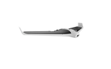
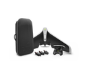
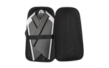
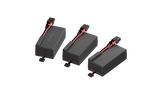
With a Parrot Disco-Pro AG Agriculture Drone, gathering data for NDVI—the Normalized Difference Vegetation Index—no longer requires expensive rental of satellite time and services. No helicopter, either. All you need is a compact, lightweight but sophisticated unmanned aircraft that you or an employee operates from the ground.
Parrot Disco-Pro AG drastically reduces the time and cost associated with crop inspection and crop mapping. Disco-Pro AG can cover 200 acres of crops at a 400-foot flight altitude on a single flight. That’s 200 acres in half an hour—far faster than you can examine crops from the ground, with greater detail, and with no crop damage.
The Disco-Pro AG gathers invaluable data. Its sophisticated onboard sensors can read color bands that, with the help of a cloud program, are interpreted into crop data. The data is even adjusted for the amount of sunlight at the time measurements are taken.
Parrot Disco-Pro AG Agriculture Drone features:
- Flight time: 30 minutes
- Range: 1.24 miles
- Video streaming: 360/720p
- Video recording: 1080p
- Still resolution: 14MP
- Stabilization: Digital
- Batteries: 3 (2 extra)
- Memory: 32GB internal for photos and video; 64GB for crop data
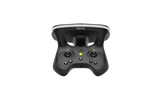
- Controller: Parrot Skycontroller 2
- Takeoff/landing: Automated
- Positioning: GPS, GLONASS, flight program
- Sensors: Multispectral and sunlight
- Data interpretation: 1-year membership in AIRINOV FIRST +
Advanced Smart Agriculture
Farming is a sophisticated business that relies increasingly on advanced technology. Yield and crop quality are only as good as the science that goes into them. The Parrot Disco-Pro AG Agriculture Drone elevates the science of crop mapping and management to new levels as it soars 400 feet above your fields.
Disco-Pro AG records everything it sees in data that can be analyzed digitally to predict and increase yield, indicate plant disease, and protect plants and soil through the proper management of pesticides and irrigation.
Easy To Assemble
Disco-Pro AG must be assembled before each flight, but it’s simple and takes only a minute.
Made from two densities of high-impact EPP, or Expanded Polypropylene foam, Disco-Pro AG is tough. It snaps together with built-in, strong carbon connectors. You do have to make sure the connections with the flaps are properly linked.
The fuselage holds the battery and C.H.U.C.K., the control module, which receives commands and makes all in-flight adjustments for banking, ascending and descending, and for recording video and stills.
It also holds separate pods to make the scientific readings and recordings: the Parrot Sequoia, which records NDVI data, and the sunshine sensor, which reads ambient light and adjusts data accordingly.
Disco-Pro AG Is Easy To Fly
Parrot Disco-Pro AG is easy to launch, fly and land.
Disco-Pro AG launches from your hand, safely and effortlessly. It returns to you and lands automatically on flat ground once you command it to.
Tell Disco-Pro AG where to go and it obeys. The Skycontroller 2 remote controller has twin joysticks and one-push buttons for commands.
Surveying a field for NDVI data is made simple through automated commands. Use the FlightPlan software and your smartphone or tablet to draw on a satellite map the field you want Disco-Pro AG to survey. You determine the overlap. Disco-Pro AG will go there and make all the turns and runs automatically. Disco returns to you with the raw data you’ll use to make important decisions on crop management.
Long Range, Live Streaming
Disco can fly 1.2 miles from your base of operations. It will receive your commands over that distance. If you fly beyond the range of your signals, don’t fret: Disco is programmed to return to you if the signal is lost.
It also will stream live video of the flight over its entire range. Live images are transmitted at clear 360p or 720p, even while the camera actually records at higher-definition 1080p.
Disco-Pro AG’s Precise Positioning
The Parrot Disco-Pro AG goes precisely where you want it to go.
GPS makes it possible to deploy your agricultural drone with pinpoint accuracy. If you bring Disco home to get a fresh battery or because you need to tend to other business, Disco-Pro AG returns to the precise point were it left off.
Disco-Pro AG’s Sophisticated Sensors
Not just any drone can gather NDVI data, or do it accurately.
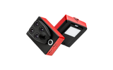
Disco-Pro AG is equipped with the Parrot Sequoia, an electronic instrument that gathers the data by measuring light coming off your crops and fields. It is basically the same process that satellites have used for years in doing NDVI measurements.
Sequoia is compact but highly capable. It fits in a protective indentation shaped for it on the bottom of the Disco-Pro AG. Sequoia consists of electronics and four cameras. Its four cameras capture four types of light, including two infrared bands invisible to the human eye:
- Green (550nm BP 40nm)
- Red (660nm BP 40nm)
- Red Edge (735nm BP 10nm)
- Near-infrared (790nm BP 40nm)
Not only does Sequoia capture these light readings, but it also adjusts for speed and height of the aircraft, and for sunlight, at the time the readings are taken. So even if the day goes from sunny to partly cloudy or completely overcast, your readings will be accurate. The sunshine sensor attaches in an indentation on the top of your Disco-Pro AG.
In addition, the Sequoia has a downward-facing RGB camera. It can snap up to one full-color image a second of crops and fields.
All images taken by Sequoia are geotagged. That means you’ll be able to determine the exact location of the field or portion of the field in each image and in each piece of data.
AIRINOV FIRST + NDVI Maps
To have your data analyzed and made into usable maps, you must upload it to AIRIN0V +, a crop analysis service that operates in the cloud. It’s simple. A one-year membership in AIRINOV + is included in your purchase.
AIRINOV + uses your data in several ways. It creates an absolute NDVI map and an adjusted NDVI map. A simple zoning map with three zones allows quick analysis of your crops. A detailed NDVI map has seven zones to help you recognize field variations and guide you in developing a plan for Variable Rate Application.
Infrared readings can also help to identify moisture levels. Infrared readings also assist in spotting crop diseases, so you can respond with prompt and proper treatment.
Quality Video and Still Photos
The Disco’s FPV camera records in 1080p high definition at 30 frames per second. That’s the same definition that you see on most high-def TV screens. It shoots stills at 14MP—better than many handheld cameras and cell phones.
The lens has a 180-degree fisheye view, so it takes in the sky as well as the ground when flying.
Although the camera is fixed, it gives a simulated tilt for a ground view by relying on its digital stabilization software. There is no gimbal to stabilize the camera, but the program removes the most of the shakes and movement from the video. You can still see the canted horizon that flying as a passenger or pilot in a plane would give you.
Recording formats include JPEG, and DNG and RAW, which allow for greater editing of images from your computer.
TECHNICAL SPECIFICATIONS
OPERATION OVERVIEW :
- Area Coverage: 80ha (200ac) in a single flight at 120m flight altitude (400ft)
- Range: Up to 2km with Parrot Skycontroller 2, in an unobstructed area free of interferences
- Ground resolution: 14.8cm/px (5.5in/px) at 120m (400ft) flight altitude
- Automatic flight plan powered by Pix4Dcapture mobile app
- Hand launch for take-off
- Automatic landing
GENERAL :
- Weight: 780gr | 28oz without Parrot Sequoia
- Take Off Weight: 940g / 33oz with Parrot Sequoia & mount
- Size: 1150x580x120mm (45x22x5in)
- Wingspan: 1150 mm (45 in)
- Removable wings for transport
PHOTO & VIDEO :
- Photo: 14Mpx wide angle camera
- Video: 1080p Full HD
- Video streaming: 360p / 720p
- Internal Memory: 32GB
WI-FI AND TRANSMISSIONS :
- Range: Up to 2km with Parrot Skycontroller 2, in an unobstructed area free of interferences
- WiFi AC-type, 2 bi-band antennas (2,4 and 5GHz)
HIGH CAPACITY BATTERY :
- Battery life: 30min with Parrot Sequoia
- 2700 mAh / 25A 3 cells Lipo Battery
SENSORS :
- Airspeed sensor (Pitot tube)
- Built-in GPS + GLONASS
- Inertial Navigation System
- Altimeter
- Ultrasound
- Optical flow camera
PARROT SEQUOIA RGB CAMERA :
- Resolution: 16 Mpx, 4608x3456 pixels
- HFOV: 63.9°
- VFOV: 50.1°
- DFOV: 73.5°
4 GLOBAL SHUTTER SINGLE-BAND CAMERAS :
- Resolution: 1.2 Mpx, 1280x960 pixels
- HFOV: 70.6°
- VFOV: 52.6°
- DFOV: 89.6°
4 SEPARATE BANDS :
- Green (550nm BP 40nm)
- Red (660nm BP 40nm)
- Red Edge (735nm BP 10nm)
- Near infrared (790nm BP 40nm)
GENERAL CHARACTERISTICS :
- Dimensions: 59x41x 28mm (2.3x1.6x1.1in)
- Weight: 72 g (2.5 oz)
- Photo mode: Up to 1 fps
- Internal storage: 64 GB built-in storage
- Inertial measurement unit & magnetometer
- Power: 5 W (~12 W peak)
SUNSHINE SENSOR (INCL. IN PARROT SEQUOIA) :
- Dimensions: 47x39.6x18.5mm (1.8x1.5x0.7in)
- Weight: 35 g (1.2 oz)
- 4 spectral sensors (same filters as body)
- GPS
- Inertial measurement unit & magnetometer
- SD Card Slot
- Power: 1 W
AIRINOV FIRST +
- Up to 150 ha / 370 acres processed per week
- Unlimited surface for the first processing
- AIRINOV reports includes:
- Absolute NDVI map: index value from -1 to 1
- Adjusted NDVI map
- Simple zoning map: NDVI map divided in 3 zones
- Detailed zoning map: NDVI map divided in 7 zones
|


